Head Office Press Office
- 13-Sep-2007 - Environment Agency consults
on future proposals for Cuckmere estuary
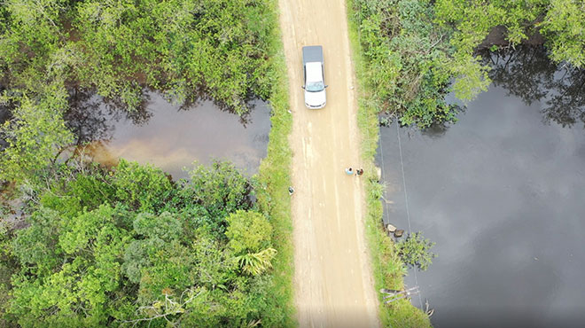
The Cuckmere estuary is considered by many
to be an icon of Sussex. But climate change,
sea level rise and past interference by
man are putting it under increasing pressure.
The Environment Agency believes the best
long-term option for the Cuckmere estuary
is to allow it to go back to being a tidal
estuary that can adapt to climate change
and today (Monday 10 September 2007) is
asking for your views on its recommendation
to stop maintaining the existing defences.
Local people and visitors now have three
months to find out more and comment on this
recommendation before it is finalised.
Harvey Bradshaw, Area Manager for Kent
and East Sussex, said: "The way we
manage flood risk here has to change. Climate
change is presenting us with many challenges.
To keep up with these changes, we would
have to do large and expensive work in the
future that would not only be environmentally
damaging but would also impact visually
on the area. This would not benefit this
popular landmark."
Each year the Environment Agency spends
up to £50,000 of flood risk management
money removing shingle from the river mouth
to reduce the risk of flooding upstream
at Alfriston and Westdean. It would cost
around £18 million to build and maintain
river and coastal defences here over the
next 100 years to cope with sea level rise.
Harvey Bradshaw continued: "There
is fierce competition for funding for flood
defences and protecting people’s homes is
rightly a priority. In these circumstances
we simply cannot justify spending flood
risk money here to protect a flood plain."
The Environment Agency has compared several
options for managing flood risk on the Cuckmere
estuary and is now recommending to stop
maintaining the defences after a two year
notice period. The existing defences would
then deteriorate but the Environment Agency
would continue to monitor the area as changes
take place.
"Our recommendation does not mean
we will abandon the Cuckmere," explained
Harvey Bradshaw.
"Until the estuary is working as it
should naturally, we will continue to remove
shingle from the mouth of the river to reduce
the risk of flooding upstream. This could
take 15 years.
"We believe a more natural estuary
will still provide plenty of opportunity
for people to continue to enjoy this wonderful
area."
The Environment Agency has today published
a consultation document that sets out the
options that have been considered and explains
the recommendation. This document is available
to download at: www.environment-agency.gov.uk/yourenv/consultations
<http://www.environment-agency.gov.uk/yourenv/consultations>
by calling 08708 506 506 or by email: cuckmere.estuary@environment-agency.gov.uk.
Anyone wanting to comment on the options
can do so before 10 December 2007. The Environment
Agency will then make a final decision on
the future management of the Cuckmere in
early 2008.
+ More
Environment Agency holds Sheffield flood
drop-ins
Francesca Glyn-Jones - 13-Sep-2007 - Staff
from the Environment Agency will be talking
to residents in Sheffield and the surrounding
area next week who were affected by the
recent flooding.
The team, based in Leeds, is holding drop-in
sessions on:
Monday, 17 September at the Pentecostal
Church, Loundside, Chapeltown;
Wednesday, 19 September at Millhouses Methodist
Church, Millhouses Lane, Millhouses;
Thursday, 20 September at Attercliffe Spiritualist
Church, Bold Street, Attercliffe;
Friday, 21 September in the Dooley’s Restaurant
at Hillsborough Football Stadium.
Representatives from Sheffield City Council
will also be at the sessions which start
at 3pm and run until 7pm.
The aim is to give residents an opportunity
to learn more about the flooding, and for
officers to gather information about how
the flooding affected specific areas.
The meetings are part of a series of drop-ins
which are being organised by the Environment
Agency across Yorkshire and North Derbyshire.
Area flood risk manager Peter Holmes said:
“We have held drop-in sessions in Barnsley,
Doncaster, Rotherham and Chesterfield, and
we have had a very positive response from
people who have attended.
“They have given us an opportunity to explain
our initial findings to residents about
the flooding in their area, what we have
been doing since June, and what the plans
are for the future.
“We have been able to sign up more people
for our free flood warning service, and
residents have provided us with valuable
information including photographs and their
personal experiences of the flood which
has helped us to put together a more comprehensive
picture of what happened.”
Staff want people at the drop-in sessions
to tell them how the flooding affected different
homes and streets because the more they
know, the more they can do to find ways
of protecting them.
They are also urging residents to come
along with photographs, and any other documentation
which they can use to plot the path and
the times of the flooding more specifically.
Sheffield City Council chief executive
Sir Bob Kerslake said: “In addition to finding
out more about the background of the flooding,
I would urge anyone affected by the floods
to attend one of these meetings to let us
know what you think of the response of the
Environment Agency, the council and other
partners involved.
“Wherever the nearest meeting is to you
then please go along. Your views are vital
in influencing how we respond to any similar
incident in the future, should they occur.”
Over the 12 hours worst hit by rain on
June 25, it is estimated that 400 million
tonnes of rain fell across the affected
area of south and west Yorkshire, and Humberside
– this is equal to the water from 18 Olympic
swimming pools falling every second.
The Environment Agency can provide flood
protection from main rivers and designated
smaller watercourses.
It also issues flood warnings and watches
to people in certain flood risk areas who
have signed up to receive the service.
The Environment Agency has gauges on many
main rivers across Yorkshire which helps
officers to monitor water levels and the
likelihood of flooding.