Take a Five
Second Flight to Top Environmental Hot Spots
- Nairobi/Washington DC, 4 September 2008-
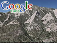
People can ‘fly’ to some of the world’s
most dramatic environmental hotspots courtesy
of the UN Environment Programme (UNEP)’s
innovative use of the popular mapping tool
Google Earth.
The new computer service
allows armchair environmentalists as well
as politicians, researchers and business
executives to zoom in, whizz past and monitor
close to 200 sites.
Here they can witness
at first hand in 3D the impacts of climate
change and other destructive human activities
on the earth’s environment and natural resources.
Highlights include the
appearance of road networks in the remote
rainforests of the Democratic Republic of
Congo and the dramatic expansion of many
West African cities.
Other highlights, presented
as a series of ‘before and after’ images
include the surprising changes in the glaciers
of Greenland and Alaska and the loss of
biodiversity-rich spiny forests to farms
in Madagascar.
Achim Steiner, UN Under-Secretary
General and UNEP Executive Director, said:”
If we are to change the hearts and minds
of the global public we need to surprise,
to excite and occasionally perhaps to shock.
These images, allied to modern computer
technology, do all three”.
“But these ‘fly-by’
satellite sets do more. They also show humanity
is equally capable of positive, intelligent
and empowering change-from the re-forestation
of parts of Niger to a new management plan
for the Itezhi-tezhi Dam in Zambia which
is helping to restore natural and seasonal
flooding,” he said.
These virtual ‘trips’
are featured in UNEP’s popular series of
changing environment atlases including “One
Planet many people: Atlas of our Changing
Environment” from 2005 and the recently
released "Africa, Atlas of Our Changing
Environment."
Notes to Editors
On September 13, 2006,
the Google Earth team released “UNEP Atlas
of our Changing Environment” as a part of
the Featured Content layer including these
environmental hotspots through their worldwide
distributed data servers.
On April 10, 2007, Google
Earth released the new UNEP materials for
120 environmental hotspots (the original
Atlas has information on 79 environmental
hotspots).
Google Earth created
a new folder, called "Global Awareness”
to showcase featured layers that are non-profit,
public-benefit - where they want to help
draw the world's attention to an issue.
Google Earth has over 300 million users
worldwide. This release incorporates the
latest technological tools developed by
Google Earth.
Project coordinator,
Ashbindu Singh, of UNEP's Division of Early
Warning and Assessment said: "Google
Earth technology already allows a more informative
and accessible means of delivering information
about our changing environment. By keeping
pace with the changing world of technology
and media, UNEP helps the environmental
community keep pace with the real changes
in our real world."
The new service contributes
to The International Year of Planet Earth
which aims to capture people’s imagination
with the exciting knowledge we possess about
our planet, and to see that knowledge used
to make the Earth a safer, healthier and
wealthier place for our children and grandchildren.
The International Year
runs from January 2007 to December 2009,
the central year of the triennium (2008)
having been proclaimed by the UN General
Assembly as the UN Year. The UN sees the
Year as a contribution to sustainable development
targets as it promotes wise (sustainable)
use of Earth materials and encourages better
planning and management to reduce risks
for the world’s inhabitants.
One Planet Many People:
Atlas of Our Changing Environment and Africa:
Atlas of Our Changing Environment are available
to view at http://na.unep.net and at http://earth.google.com/
Both are available to
purchase from UNEP's online bookstore http://www.earthprint.com
More Information Please Contact Nick Nuttall,
UNEP Spokesperson